
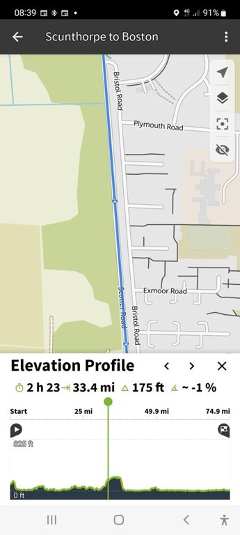
Corner to Corner, Day 54: Scunthorpe to Boston
https://www.cycling4charity.org.uk
Report at the time:
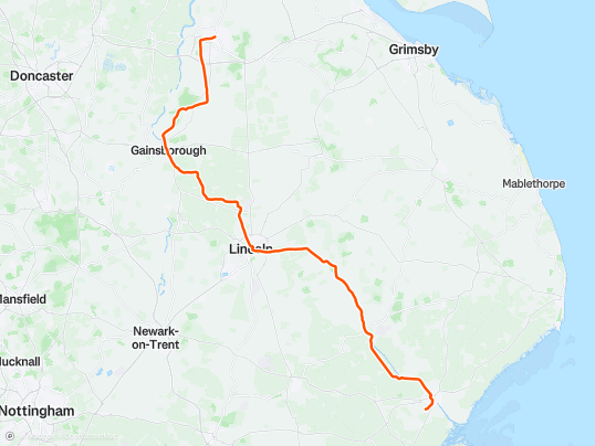
Glorious day. Flat straight roads near the start and end. Unknowingly, our route followed the 100% tarmacked Water Rail Way. With lots of history to learn about.
Last night's hotel owner/chef gave us each a glass jar of food from Sicily which we gave to our impromptu lunch host and friend after she saw the C2C map on my jersey whilst cycling behind me.
This evening's hosts knew we'd coming from Scunthorpe, having googled us, found and studied the website.
Added at a later date:
Bike touring routes created by Komoot for York to Epping:
Without adjusting: 244 miles, climbing 7275ft, incl. Sheffield, Nottingham, Leicester & Milton Keynes. For road cycling: 200m, 4150ft, 26miles of A road.
Via Humber Bridge: 232m, 4350ft, incl. Boston, Peterborough, Cambridge.
then via Brigg: 237m, 3925ft, incl.Lincoln, B, P, C.
If HB then Scunthorpe hotel: 242m, 4250ft, inc; L, B, P & C.
We used the flatter route created from York which included Gainsborough, Boston, Ely and Cambridge, before adding our east Scunthorpe hotel.
Gainsborough roads were busy.
With 31.5 miles still to go, we followed the Water Rail Way from its start in Lincoln, diverting only for non-paved section Bardney-Southrey. A YouTube video advises our diversion in or after rain.The former railway it follows was the Lincolnshire Loop Line.
4.8 mile North Forty Foot Bank absolutely straight just outside Boston.
Distance
76.0 mi
Elev Gain
869 ft
Time
6h 40m


0:17

0:26


0:30


0:14


0:22


